ANCIENT NAME GIVEN TO THE ISLANDS
by: Carlos Quirino
July 2016–The different Island of the Philippine archipelago had bad various names in history. The native inhabitants had their own names, but as each wave of foreign voyagers touch these places they either baptized them with their own appellation or misspelled the native names due to differences of language and pronunciation. To worsen the confusion map maker gave the different names to the same place. The list based on that first prepared by Pardo de Tavera, enumerates alphabetically the names given to islands and places in the Philippines mentioned in ancient maps.
Aboea Mucho primero – Where Magellan first entered the Philippines in its eastern central part and duly marked by cartographers of the late sixteenth century.
Abuya – One of the ancient names for Leyte derived from Abuyog a town on the lower eastern coast of that island. Appear in Herrera (1601), Baeu (1650) Sanson (1654), Visecher (1710, Mortier (1710)Aa
Achan – One of the names given to Samar or its northern half.
Aquarina – A town in Lingayen Gulf in northern Luzon mentioned by Kaerius (1598) and Bertius (1643). Sanson calls it Pangasinan.
Assan – Another name for Marinduque.
Balabao – The straight south of Palawan near Borneo named after an island, which the magallanic expedition saw Pigafetta called it Bilalon, which Ramussio (1554), Ortelius (1570) and Mercator (1678) included although they placed it next to Jolo or Sulu.
Banguey – This Island, located between Balabac and northern Borneo must have been the one called by Pigafetta as Cimbabon and duly recorded by Ortelius and Mectator in their maps.
Banto – A name which could have applied to the island of Sibuyan, according to Sanson, although it has not been properly located.
Barussae – Ptolemy gave this name to some islands which Gerald Mectator indicated might have been the Philippines.
Basilan – In September of 1521 the Victoria “Victoria” sailed near this island which Pigafetta called Taghima. Santa Cruz (1545) called it Tanguima Ramussio (1654) Taglima, Ortelius and Mectator changed it to Tagema and Coroneli (1696) to Tagyto. Father Colin (1659) called it Basila, nearer its present day
Batan – The Jpananese called the Bashi islands in northernmost Luzon by its name.
Baybay – The name of a town on the western coast of Leyte. Pigafetta applied it to the northern part of the island which he thought was divided into two. Thus Ramussio wrote it down on his map.
Bibalon – The name given by Pigafetta to an island near the Jolo archipelago.
Filipina – Mortier gave the name Philippine to the island Samar. Ramussio calls an island by the name in his map. Herrera presumes that this name was given to Samar “because it was the first discovered in the archipelago. Actually, Villalobos in 1543 gave that name to Leyte in the home of the Crown Prince of Spain, and at first the archipelago was known as Felipina rather than Filipina. Ludovico George (1584)
named indistinct islands “Philippines” to represent vaguely Luzon.
Francisco Gomez – This name has been indicated as some islands east of Samar by early cartographers like Kaerius, Hondius, etc. We have been able to find out the source.
Gabion – A name given by Aa to an island, presumably Burias although he drew it incorrectly larger than
Guimaras – Discovered by Legazpi this island off Panay was first mentioned by Tirion (1633) as Imaras. Colin called it correctly by its present name.
Humunu – See Bueno Señal
Ibabao – One of the old names for Samar
Iloques – Mistakenly given to the Cagayan de Sulu islands, although later cartographers correctly placed it in northern Luzon.
Jolo – Pigafetta called is Zolo and it has appeared on maps as Solo, Sooloo, Xollo, Zulu and Socloeh. Spanish name for Sulu.
Kapul – Mortier gave this name to an islet north of Palawan. Capul is actually an island in San Bernardino
Strait between southernmost Luzon and Samar.
La Baye ka Baye – The name given Albay in southern Luzon by Admiral van Noort in 1600 and in an illustration included in De bry’s Voyages (1602).
Leyte – The Magallanes expedition did not stop at this island. Pigafetta assumed that is was composed of two islands. Baybay to the north of Caylon to the south. Ramussio calls it Filipina while Ortelius and Mercator lumped Subuc, Matham and Abuyo into one island. Herrera, Sanson, Blaeu, Coronelli, Mortier, Visscher etc. called the island Abuyo. Colin named it correctly. Leyte and Samar are often been interchange and both have been called Caylon or Sailon. Nevertheless leyte has been known as Baybay, Ceylon or Sailon, Filipina, Abuyo and Sabura.
Limasana – A small island soutj of Leyte and west of Panaon or caylon. Here on Easter Sunday or March 31, 1521 the Spaniards celebrated the first mass. Pigafetta called it Mazawa. Both Ortelius and Mercator named it Messana and indicated it is a town in Butuan (northeastern Mindanao) probably because the chieftain of that place exercised sovereignty over the island now known as Limasawa.
Lomiaton – A town in Northern Mindanao, in the vicinity of present day Iligan or Misamis.
Lubang – An island south of the entrance to Manila Bay, firast visited by Salcedo in 1569. Colin called it luba, Visscher and Vaugondy (1750) named it Luban.
Luzon – The largest island in the archipelago, known first to chinese as Liusung. The Portuguese chronicler Pires (1512) called it Lucoes, Murillo Velarde (1734) believed the name was derived from the Tagalog word Lusong the wooden mortar used in pounding their rice. European map makers spelled in Luconia until the French cartographer Sanson d’Abbevile (1654) used the cedilla to soften the hard C to
its pronunciation. Both Magellan and Legazpi had heard of it in their voyage from native sailors, but only the latter had the opportunity to exploit this information. Western maps did not depict this island until a couple of decades after Legazpi had explored it: de Jorde (1593) Linschoten (1595) and Kaerius (1598) were the first to do so. Japanese knew it as Ruson or Roson.
Mactan – A small island near Cebu where Magellan died on Saturday, April 27 1521 Pigafetta called it
Mattam and Matan; others Mathan.
Mait – The old Name for Mindoro. This has not been used in any European map although early early Chinese accounts (Chua Ju Kua) and maps (the Hun –i) called it Ma-I or Ma-yi.
Malandik – An ancient name for Marinduque.
Malhon – Another early name for Homonhon or Humunu.
Mamaylan – The Visayans, according to Loarca, gave this name to Negros Island. Probably a contraction of Himamaylan, a generic term for that place.
Mandana – Another early name for Mindanao.
Mandoto – An island on the eastern coast of Luzon, either Jomalis or Alabat. However this name is given to a point on the other side of Luzon, probably Cape Bolinao.
Manila – The early tagalog called it Maynila, a flourishing town in the southern mouth of Pasig River, which Legazpi seized in 1570 to establish the capital of the archipelago. Probably known to charge mariners as Ma-li- lu before the arrival of Spaniards. Luzon Island in European mapscirca 1590, the name
Manila – or Manilla and Manilha began to be written down although its exact location was not always properly placed. By the eighteenth century, the same name Manila often was better known abroad than
Philippines: viz. Manila galleons “Manton de manila“ Manila rope and Manila men for sailors who settled in Louisiana.
Marinduque – An island south of Luzon which Sanson mistakenly called Luban. Vaugondy (1750) called it
Masbate – An island in the Visayan group discovered by Guzman in 1569, who was a member of the Legazpi expedition. Both Jansonius (1650) and Van der Aa (1720) called the neighboring island of Ticao and Burias,Matabaon and Mataban respectively.
Mataban and Matabaon – see Masbate.
Matalahambre – The descriptive name of a gulf on eastern coast of Luzon, around present day Baler, probably given by some early voyager because he found food there to assuage his hunger.
Mauritius – Sansonb, Bertius and Visscher christened Cagayan de Sulu with his name.
Messana – A variation of Mazawa for Limasana or Limasawa.
Mindanao – The second largest island in the archipelago and known to western map makers ahead of Luzon because of Magellan, Loaisa, Saavedra and Villalobos first tarried there. Ramussio calls it
Vendanao, Herrera Madana and Santa Cruz Mendanao.It assumed pretty much of its present shape only with the map of Colin in1659. The Japanese in their Portolan charts called it Mitanao.
Maniolae – A group of islands named by Ptolemy and believed at first to have referred to Manila because of the phonetic similarity.
Mindoro – An island of south Central Luzon, first discovered by Salcedo in 1569. Known to early Chinese as Mait or ma-I and may-i. Mercator, is named it Mudara while Herrera wrongly called it Mindanao. Called Mindora by late sixteenth century cartographers.
Minolo – Apparently a primitive name for Mindoro.
Mitanao – The Japanese name for Mindanao. The Portuguese adventurer Francisco Serrao was said to have landed there in 1512.
Nayon – Loarca says this name was given to Negros by the Visayans. Probably an erroneous imputation.
Nebui – The region now known as Camarines in southern Luzon.
Negros – Known to the Bisayan as Buglas, according to Povedano, although the Pigafetta called it Panilogan. Ramussio and Santa Cruz both called it as the abode of negroes or black people.
Osigan – Old name of Tablas, according to Loarca.
Palawan – the Island stretching along the southwestern flank of the archipelago and known variously as
Paragua by the Spaniards, Paloban by Ramussio, Pulnam by Schoner (1523) and Palaoan by Pigafetta. Mercator said this was the Bazacata of Ptolemy.
Panaon – An islet south of Leyte sometimes called Sailon, and confused with Panay, as did Van der Aa.
Panay – the Island in the Visayan group conquered by Legazpi known to Ortelius and Mercator as Panoadas. In a later map, Mercator termed it Panama, likewise Langren (1595) Linschoten (1595) Kaerius (1598) and Bertius (16430.
Panevasion – Bertius thus named a town in western Luzon, probably after a Pangasinan. Also in Linschoten, Kaerius et al.
Pangasi – An abbreviation name for Pangasinan.
Papauas – Ramussio called an island in central Philippines by the name probably negros.
Paragua – Spanish name for Palawan, one of the island visited by the Megellanic expedition. Langren,
Hondius and bertius called it Calamianes while Tirion (1633) Jansonnius (1656) and Blaeu (1650) called it Paragoya.
Pondam – Most probably an early name for Polillo on the eastern cost of Luzon.
Poniente, Islas del – Although Magellan gave the name Islas de San Lazaro to the Philippines, it was also called and known to Spaniards of the sixteenth century as Islas del Poniente (Isles of the west) until re-christened by Villalobos in 1543 to its present name.
Primer Surgidero – The pilots of Legazpi thus termed the spot where they anchored in the Philippines, on the eastern coast of Samar, and these words have appeared on atleast ahlf a dozen early maps of that epoch.
Puloan – One of the early names for Palawan.
Quepsia – Mentioned by Alonso de Santa as the best port in northern Mindanao. Could it have been Dapitan.
Rebujan – A name given by Mortier on his map of Asia, probably Tablas or Romblon.
Ruson – The Japanese name for Luzon, inasmuch as there is no letter L in Japanese.
Sabura – Langren, Kaerius, Hondius and Bartius gave Leyte that name.
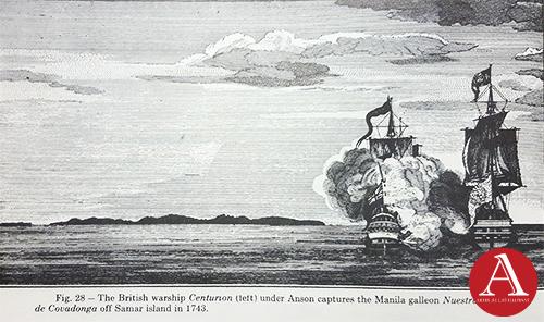
Samar – According to Pigafetta, there expedition merely sighted but did not land on that island. Both Villalobos and Legazpi landed here, but at different places. It was known as Zamal and Tandaya or Taridola. The northern part has been called Achan by Jaerius, Sanson, Hondius, Du val and Berius. Tirion
called the southern part Ibabao.
San Juan – An imaginary island supposedly located nearest of Mindanao, first drawn by Herrera in 1601 and copied assiduously by Sanson, Tirion, Coroneli, Hondius, Jansonnius, Duval, Dudley (1646) etc. Neither Colin nor Murillo Velarde, of course included it in their maps. As late as 1850, the friars Buzeta and Bravo who should have known better I their “Diccinario Geografico” describe this imaginbary place as “ vastly forested” wherein some ferocious animal could be found.
San Lazaro – The name given to the archipelago by Magellan because he discovered it in the Sabbath of Saint Lazarus.
Sebadibae Insulae – Dr. Pardo de Tavera attest that he saw this inscription written on a chart of the Philippines by Sanson (1652) in the Bibliotheque Nationale of Paris.
Sibuguey – One of the names give to the coast of Caraga in the northern Mindanao, also known as Candigar.
Sibuyan – A small island near Romblon and Tablas in the in the northern part of Visayas, which were first explored at the behest of Legazpi
San-hsu – The earliest Chinese name for the Visayan islands, and literally meaning “the three islands”.
Siday – The name of a region on western Luzon given by cartographers like Mercator, Langren, Kaerius, Bertius and others probably after Sinay in the Ilocos Provinces.
Siquijor – Although discovered at the time of Legazpi, it was not named until Colin did so in 1659 who called it Sulaguan.
Solar – A variation of Jolo and Zsolo (Pigafetta).
Suluan – See Buena Señal.
Suricao – The misspelled name for Surigao in Northern Mindanao where Magella paused on his trip to the Visyas in 1521.
Tablas – See Sibuyan.
Tandaya – One of the first names given to Samar. This was in reality the name of the Cieftain who governed a part of that island, and when the Spaniards under Legazpi ask for the name of the place the nephew of the chieftain gave his uncle’s name, which the foreigners mistakenly applied to that place. Also spelled Tandara and Tandola. See Samar.
Tapobrana – At first believed to be Ceylon, because of its location in Ptolemys maps but later identified as Sumatra.
Ticao – A small island between Masbate and southernwestern Luzon, marked by Sanson and Colin.
Zubut – A variation for the island of Cebu.
NOTE: This is a chapter culled from Carlos Quirino’s book, Philippine Cartography (1320-1899).